Introduction
In waterfront projects, value is not measured by buildings alone, but by the quality of public space and its ability to be usable daily and year-round. In Jazan, where summers are hot and humid, thermal comfort, shade quality, and walking paths become essential to the destination's success and its impact on quality of life and the urban environment.
This report translates the impact of public spaces in the Zan Waterfront project into measurable quantitative indicators, focusing on: walkability, actual year-round usage, thermal comfort indicators, and community impact.
Key Findings Summary
- Enhanced open spaces within the project: 200,000 sqm (approximately 67% of the 300,000 sqm site area).
- 15-minute walkability range (1,200m): 8,473 current residents, estimated 25,449 residents upon completion within the range.
- Extended range 2,400m: 31,962 current residents, estimated 73,984 residents upon completion within the range.
- Expected open space usage (base case): approximately 6.05 million visits/year averaging 16,600 visits/day. Winter daily average rises to approximately 24,000 visits/day, dropping in summer to approximately 11,300 visits/day.
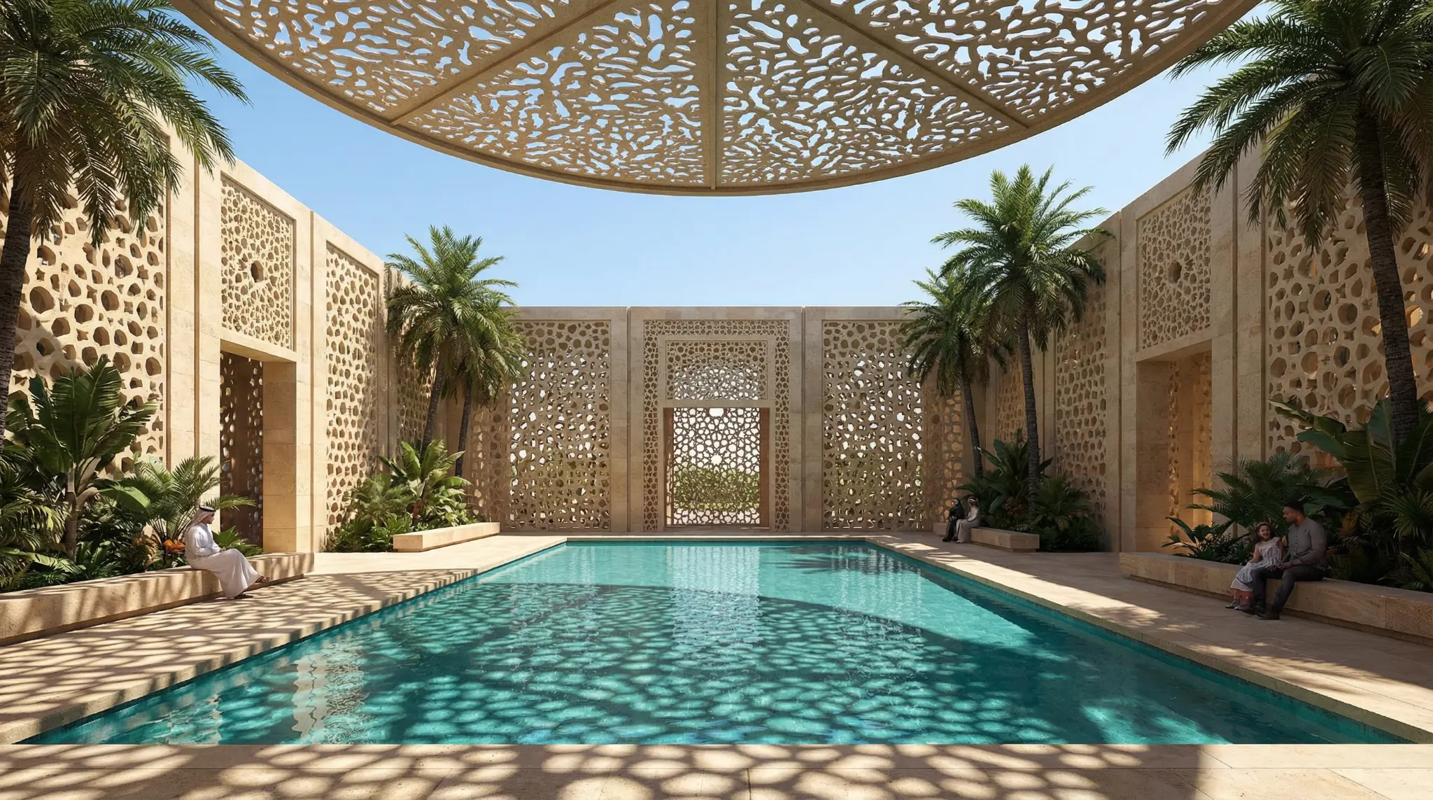
- Thermal comfort indicators (minimum per hot climate planning reference): 3.6 km connected shaded pathways, 40,000 sqm shade zones, and 8 shaded rest points minimum, with a recommendation to increase total shade coverage to approximately 35% (i.e., 70,000 sqm) supported by thermal comfort solutions at selected points to enhance summer usability.
Project Overview
The Zan Waterfront project in Jazan is a waterfront development with a site area of approximately 300,000 sqm, combining commercial, hospitality, and entertainment components with extensive public space. The project's advantage is that open spaces constitute the majority of the site (200,000 sqm), making walking, seating, and events an essential part of the destination's value.
Study Objective
The study focuses on four axes:
- Estimating the population that can reach the site on foot within 15 minutes, linking this to presentable figures.
- Converting general visit economics into actual open space usage considering Jazan's seasonality.
- Translating thermal comfort requirements (shade and rest points) into measurable quantities.
- Providing a realistic reading of health and community impact related to walking and physical activity.
Study Scope & Limitations
- Spatial scope within the project: Includes only enhanced open spaces within site boundaries (200,000 sqm).
- Access analysis: Based on actual ranges around project boundaries as provided from your analysis (population, plots, lands, and buildings).
- Usage estimation: Based on the project's annual visit model (internal study) then converted to open space visits through an assumed usage ratio.
- Important limitations: Figures are planning estimates subject to update when detailed landscape plans, final pedestrian network, and approved events program become available.
Methodology & Assumptions
Results were built through four interconnected modules, keeping each step auditable:
- Module 1: 15-minute walkability. Using the standard of approximately 5 minutes = 400m as used in planning accessibility studies (ref [2]).
- Module 2: Population estimation at build completion. Through average population per built land formula then generalizing to total plots within range (project team inputs).
- Module 3: Converting annual visits to actual open space usage. Using a usage ratio (base case = 85%) then simplified seasonal distribution reflecting Jazan's climate (ref [1]).
- Module 4: Thermal comfort. Based on planning reference for hot environments, then translated into quantities within 200,000 sqm (ref [3]).
15-Minute Walkability & Extended 2,400m Range
Instead of assuming general densities, the study relied on actual ranges around project boundaries as provided from your analysis.
| Range | Area | Current Population | Population at Completion (Est.) | Total Plots | Lands | Plots with Buildings |
|---|---|---|---|---|---|---|
| 15-min walk (1,200m) | 7,557,360 sqm (7.56 km²) | 8,473 | 25,449 | 4,268 | 2,844 | 1,421 |
| 2,400m | 22,495,843 sqm (22.50 km²) | 31,962 | 73,984 | 8,310 | 4,713 | 3,590 |
Estimation Formula Used
- Average population per built land = Current population ÷ Number of lands with buildings
- Population at completion = Average population per built land × Total plots
Formula Results
- Within 15-min walk (1,200m): 8,473 ÷ 1,421 = 5.96 persons/built land; 5.96 × 4,268 ≈ 25,449 residents.
- Within 2,400m: 31,962 ÷ 3,590 = 8.90 persons/built land; 8.90 × 8,310 ≈ 73,984 residents.
As Percentage of Jazan City Population (200,911 per 2022 census, ref [1])
| Range | Current | At Completion |
|---|---|---|
| 15-min walk (1,200m) | 4.2% | 12.7% |
| 2,400m | 15.9% | 36.8% |
Direct QoL Indicator: Open Space per Resident
Open space share (200,000 sqm) per resident within access ranges was calculated:
| Range | Current (sqm/person) | At Completion (sqm/person) |
|---|---|---|
| 15-min walk (1,200m) | 23.6 | 7.9 |
| 2,400m | 6.3 | 2.7 |
Expected Open Space Usage Year-Round
- Total annual destination visits (base case): 7.12 million visits/year
- Open space usage ratio within destination (base case): 85%
Result:
- Annual open space visits: 7.12M × 85% = 6.052 million visits/year
- Daily average: 6.052M ÷ 365 ≈ 16,600 visits/day
Seasonality
| Period | Index | Average Daily Visits (based on 16,600) |
|---|---|---|
| Winter (Dec-Feb) | 1.45× | ≈ 24,000 |
| Transitional (Mar-Apr, Oct-Nov) | 1.05× | ≈ 17,400 |
| Summer (May-Sep) | 0.68× | ≈ 11,300 |
Simplified Capacity Check
- Effective usage hours: 10 hours/day
- Average dwell time: 45 minutes
- Peak concurrent occupancy (winter): 24,000 × 0.75 ÷ 10 ≈ 1,800 people simultaneously
- Space per person concurrently: 200,000 ÷ 1,800 ≈ 111 sqm/person
Sensitivity Summary
| Scenario | Destination Visits (M/year) | Open Space Usage Ratio | Open Space Visits (M/year) | Daily Average |
|---|---|---|---|---|
| Conservative | 5.9 | 75% | 4.43 | ≈ 12,100 |
| Base | 7.12 | 85% | 6.05 | ≈ 16,600 |
| High | 8.7 | 90% | 7.83 | ≈ 21,500 |
Thermal Comfort: Shade, Pedestrian Paths & Rest Points
Shade Reference Standard
- Continuous shade for 80% of main pathways.
- Continuous shade for 60% of secondary pathways.
- Shaded rest point every 500m on main pathways, every 1000m on secondary pathways.
- 80% shade for formal gathering areas and 40% for informal gatherings.
Standard Translation to Quantitative Program within 200,000 sqm
| Item | Operational Assumption | Note |
|---|---|---|
| Main pathways (promenade/corniche) | 30,000 sqm | 3.0 km × 10m |
| Secondary pathways (internal links) | 10,000 sqm | 2.0 km × 5m |
| Gathering plazas | 15,000 sqm | 10,000 formal + 5,000 informal |
| Green spaces/seating/beaches | 145,000 sqm | Remainder of 200,000 sqm |
Outputs (Minimum)
- Connected shaded pathway length: 3.6 km
- Shade zone area: 40,000 sqm
- Shaded rest points: 8 points
Operational Recommendation
- Target: 70,000 sqm shade zones (instead of 40,000 sqm minimum).
- Gap: Adding approximately 30,000 sqm shade through dense planting, canopies, and arcades.
- Additional support: Thermal comfort solutions at selected points such as cooled seating areas or localized cooling to enhance summer usability, without assuming they cover all outdoor spaces.
Health & Community Impact
The World Health Organization confirms that regular physical activity improves health and reduces chronic disease risks (ref [5]). Therefore, having a usable promenade and waterfront, especially with shade and comfortable pathways, increases the likelihood of daily or weekly walking for nearby residents and enhances community interaction opportunities in a safe and attractive public environment.
Conclusion
- The project adds 200,000 sqm of enhanced public space, a key value element as it constitutes approximately two-thirds of the site.
- The site serves a significant population: up to 25,449 residents within 15-minute walk (1,200m), and up to 73,984 residents within 2,400m upon completion of surrounding development.
- Expected open space usage (base case): 6.05 million visits annually, averaging 16,600 visits daily, with winter peak approaching 24,000 visits daily.
- Climate-responsive design is key to maintaining year-round usage: minimum 3.6 km shaded pathways, 40,000 sqm shade, and 8 rest points, with recommendation to reach 70,000 sqm shade and localized thermal comfort solutions.
References
- Saudipedia. Jazan City. Saudipedia. Accessed: 22 Feb 2026. https://saudipedia.com/en/jazan-city
- Fareham Borough Council. Background Paper: Accessibility Study. 2018. Link
- Abu Dhabi Urban Planning Council (UPC). Abu Dhabi Public Realm Design Manual (PRDM). Link
- Abu Dhabi Urban Planning Council. Abu Dhabi Public Realm Design Manual - Application for the 2011 ISOCARP Award. July 2011. Link
- World Health Organization (WHO). Physical activity - Fact sheet. Updated 26 June 2024. Link
- Tourism and Visit Impact Model for Zan Waterfront Project - Jazan. Internal project document. ZAN. 2026.